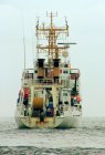
| Main Dimensions |
| Length |
72.63
|
| Freeboard to Work Deck (m) | 2.5 |
| Draft (m) | 4.9 |
| Main Vessel Activity |
| Main Activity |
Multiple activities
|
| Operating area |
Mediterranean Sea; Atlantic Ocean; Antarctic Seas
|
| Capacities and Working Spaces |
| Gross Tons | 1408.0 |
| Capacity Dry Cargo Area (m3) | 500.0 |
| Fuel Capacity (m3) | 282.56 |
| Area Wetlab (m2) | 60.0 |
| Area Drylab | 116.0 |
| Water Gen (m3) | 13.0 |
| Free Deck Area (m2) | 200.0 |
| Range, Speed and Endurance |
| Range (n mi) | 8500.0 |
| Speed Cruise (kt) | 12.0 |
| Speed Max (kt) | 13.5 |
| Endurance (days) | 30 |
| Accommodation |
| Crew | 17 |
| Scientists | 12 |
| Air Cond (yes/no) | yes |
| Data Processing Equipment: |
| Data Processing Computers | 1 PC is available for seismic data QC and real time processing (VISTA GEDCO software package); 1 PC is available for swath bathymetry data QC and processing (PDS2000 and Caris software packages) |
| Data Processing Printers/Plotters | 2 HP Plotter are available onboard |
| Coring Specifications: |
| Core Gravity | Gravity corer (Head 1.2 tons, max core length 5 m). Operations are monitored by a Van Veen load cell controller |
| Engineering Design Particulars |
| Ice Breaking (yes/no) | No |
| Hull Material | Steel |
| Engines |
Engine Number: 2
Engine Make: Diesel
Engine Power: 1760
Propeller Diam: 2.6
Propeller Max RPM: 500
|
| Electrical Systems |
AC Voltage: 230/400V
AC Voltage KVA: 860
AC Voltage Phases: 3
AC Voltage Freq: 50
AC Voltage Stabilized (Science use): 220
AC Freq Stabilized (Science use): 50
AC Amps Stabilized (Science use): 90
DC Voltages: --
|
| Fixed Equipment |
| Navigation and Communication: |
| Navigational Equipment | Radar: SELESMAR MOD. 1645 9X, SPERRY RASCAR 3400 M, DECCA BRIDGE MASTER; Gyrocompass: ANSCHUTZ STANDARD IV 110-304; Logs: EM PLATH Naviknot; JOKOGAWA EM Log; Primary Scientific Navigation System: PDS2000. Motion Reference Unit (MRU)– IXSEA Phins – interfaced to MBES |
| Communications | GMDSS: SKANTI Complete station, certified for zones A1, A2, A3 |
| Satellite Communications | Inmarsat B SATURN NERA 3S EB |
| Global Positioning System Equipment | Positioning: Primary: Ashtec Aquarius, Secondary: Topcon GB-500 (GPS + Glonass), DGPS : Landstar MK Veripos. |
| Acoustics and Profiling: |
| Acoustic Echosounder | Hull mounted 18 kHz SBES Simrad EA-500. |
| Acoustic Sonar | Hull mounted Sub Bottom Profiler Benthos CAP-6600 – consisting of 16 AT471 hull-mounted transducers, Sweep: 2-7 khz |
| Sidescan | Hull mounted 12 kHz MBES Reson Seabat 8150 for deep water surveys and 100 kHz MBES Reson Seabat 8111 for shallow water surveys. Sound Velocity Probe – Reson SVP 25 |
| Multibeam | Hull mounted 12 kHz MBES Reson Seabat 8150 for deep water surveys and 100 kHz MBES Reson Seabat 8111 for shallow water surveys. Sound Velocity Probe – Reson SVP 25 |
| Acoustic Doppler Current Profilers | Hull mounted RDI OS 75 KHZ Acoustic Doppler Current Profiler (ADCP) |
| Oceanographic: |
| Winches |
Winches (number): 1
|
| Gantry |
Gantry Location: Midships
Gantry Max Load: 8.0
|
| Crane |
Crane Location: Stern
Crane Max Load (tons): 1.0
|
| Vessel Construction and Maintenance Supervision |
| Charter availability |
Yes
|
| Vessel classification |
Oceangoing Research Vessel 1C
|
| Other equipment specifications | Seismic Prospecting: 3 Built in, 4 stage, LMF compressors operating at 140 bar (capacity 23000 l/min each). Seismic Source: 2 Sercel GI guns (2*355 cu inch) for high resolution surveys; 1 Sodera Water Gun S16 (16 cu inch) for very high resolution surveys. Gun controller: Real Time Systems – Big Shot (16 channels) |